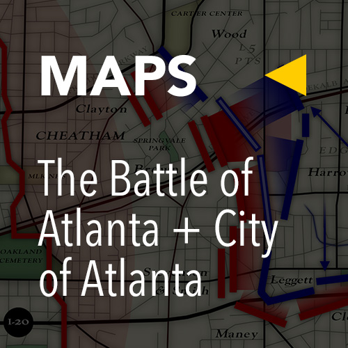
Beginning late on July 21, 1864, and throughout the close early morning darkness of July 22, Lt. General William Hardee marched out his entire Confederate corps. The march began with three of Hardee’s four divisions filing out of Atlanta’s outer defenses north of town, consolidating their columns around the modern intersection of Peachtree and Spring Streets and then proceeding south through the then compact downtown of Atlanta (roughly contained within an area of the modern-city bordered by Fulton Street to the south, Northside Drive to the west, Ponce De Leon Avenue to the north and the I-75 / 85 Connector to the east). Just south of the rail terminals downtown, a fourth division—that of Maj. General Patrick Cleburne—joined the tail of the march, completing the corps. Several miles long, and including a full compliment of artillery and a cavalry detachment, this large force would march south beyond the southern perimeter of their outer defenses and out into a then rural countryside. Once beyond the eyes of possible Union scouts, the entire corps would turn back to the north and get into position beyond the left flank of the U.S. Army of the Tennessee. One of three Union armies then closing in on the city, this one had fought its way into a threatening position and astride a vital rail link due east of the city only the previous day. From a point beyond the left of that Union line, Hardee’s force would launch a surprise—dawn—attack. As they “rolled up” the Union left and drove them back in confusion on the center of their line, C.S. Maj. General Benjamin Franklin Cheatham’s Corps would march straight out of the Atlanta defenses and smash into a then—as hoped and planned—’wavering’ Union center. Such ferocious pressure would unhinge the entire Union position and clear the vital railroad-lifeline. This was the plan of the newly installed, overtly aggressive chief of the C.S. Army of Tennessee, Lt. General John Bell Hood. The fate of Atlanta and to a large degree the Confederacy itself would rely on the outcome of this day.
Our original full-length tour on July 22, 2004, was to encompass 36 stops; but off-script on-the-spot stops pinned the number closer to 50. Since, we have honed it to a lean-mean 30 stops. Many are only a single roadside marker, others wide-ranging walkable areas. But despite vital detail and context added over time, July 22, 2004, still grounds this documentary. In addition, fixing it as our start-point now informs a “long-game” strategy, in that we continue to append the battlefield’s slow—occasionally rapid—shift through the recent past to our documentation of the distant past. It is where we continue to start … Our “moving out” that Thursday morning in 2004 (the battle itself fought on a Friday) was strategically positioned post-rush-hour. By 10 a.m. it already felt like it was 100°. This would be my overriding thought that day and every summer-tour since: fighting with powder-fired weapons (that coughed up clouds of sulfuric smoke with each shot fired) in long-sleeve wool / flannel uniforms, in that kind of heat: brutal, that word taking on a darker significance with the sickening death-toll of July 22, 1864 … The air was still, humid and bluish-grey—a common morning sky in Atlanta come summertime—as we moved south down Moreland towards the first stop on our first tour in 2004. The modern roadway had no 1864 equivalent, but runs roughly parallel to the 2-mile long position the U.S. Army of the Tennessee had taken up throughout the evening of July 21, 1864, facing west. Moreland is an enigmatic roadway; odd in that the more south you go, the more rural it seems to get. STOP 1 is about 100 yards up from the McDonough Boulevard / Moreland Ave intersection, the historical marker: “Hardee’s Night March.” This marker details the march to that point, which based on Wilbur Kurtz’s pinpoint-accurate and now classic 1937 map moved down the corridor of today’s Capitol Avenue / Hank Aaron Drive, past the sprawling Turner Field complex (and site of the old Atlanta-Fulton County Stadium where Hammerin’ Hank hit his magical #715) a few miles before turning SE on today’s McDonough—the road-routes roughly the same. The Confederate columns would have passed by where Atlanta’s Federal Penitentiary now stands (across from the intersection of Boulevard / McDonough) before filing past the spot—the first historic marker in the series documenting The Battle of Atlanta.
Hardee’s column, again several miles longs, then turned south at the intersection of today’s McDonough / Moreland to avoid detection. STOP 2 of the tour locates this half-mile jog south down modern Moreland. In the process we pass an Atlanta landmark: the Star Light Drive-In. A rarity anymore, it is still in operation and popular. Hardee’s column soon made their mentioned tack northeast up modern Fayetteville Road. At STOP 3 near the spoked intersection of Bailey and Fayetteville, used to stand the historical marker “Hardee’s March Turned N.E.” describing the re-routed march. On our 2004 tour, it took me a minute to locate it, embedded as it was in overgrown brush before the kudzu-drowned lot of a closed grocery / restaurant (refer to Stop 3 image). The marker has since been removed and not yet replaced. Despite an encouraging project to reclaim a small cemetery behind the old store, the surrounding neighborhood had, and still does have a depressed feel to it. In 2004, I clearly recall a resident standing on the front porch of a nearby house in curious wonder as I noted and photographed the marker—as if I were the first person she’d ever seen put effort to seeking it out. Oddly rural, this area could just as easily be in the south Georgia hinterlands off SR 441, as located here within a few miles of the state capitol.
The head of the bleary Confederate column soon reached a key milestone: William Cobb’s mill. STOP 4, the house / mill site, is now dominated by one of Atlanta’s wastewater treatment plants. Two markers detail the historic site and march to this point. Surrounding all of this is another odd rural-urban area: Atlanta’s Old Prison Farm. Closed for good in 1995, it is a largely forgotten space. This has had two effects. The sides of the Fayetteville / Key Road running through it are used as a dumping ground: heaps of broken furniture, renovation refuse, dead appliances, trash—at least a part of the surrounding land having found use as a designated landfill. But the other more interesting and potentially meaningful part is the 300+ acres of the one-time Prison Farm beyond the thin ribbon of roadway. It is for the moment a huge, if unintended, nature preserve. At points along the road leading up to the Cobb site, Atlanta’s skyline is visible; that is, if the grey hot haze typical of July 22 will allow it: my experience equaling distant outlines through the haze only. As well as hosting the ruins of the old prison, which burned in 2009, this stretch of roadway is also lined by several old buildings consumed in vines. To the west is a long strip of barracks, probably used in conjunction with the prison’s farm. But to the east are a number of century-old stone structures, again long unused. Caving in, their lots covered in trash, it is said that these may have originally belonged to a hunting / fishing club—a logical use of so much undeveloped rural land within the city limits, if true.
In 1864, this area not only seemed it, but was rural. Hardee pressed his columns hard. His men stumbled through the darkness up to STOP 5: the fork where today’s Bouldercrest / Fayetteville roads split. Appropriately, Hardee split his force here, looking to spread out a corps—some 14-15 thousand strong—along a broad front. Local scouts, one of them William Cobb himself, helped lead each half aimed as they were for one of two assembly-points south of modern Glenwood Avenue. (This main east-west artery splits East Atlanta and roughly delineates the southern boundary of the fighting.) Markers note the assembly points: STOP 6, the left-wing of “Cleburne & Maney’s Divisions” up on Flat Shoals / Bouldercrest in south East Atlanta; STOP 7, the right-wing of “Walker & Bate at Sugar Creek” further up Fayetteville Road, a mile SW of the renowned East Lake golf course and close to the site of Civil War era Terry’s Mill. Thousands-and-thousands of weary soldiers piled into this two-mile long expanse south of modern-day Glenwood throughout the dawn of July 22, 1864. Hardee and his commanders immediately set to preparations. But the circuitous march had covered some fifteen miles in the dead of night. Stragglers were everywhere. The troops were without rest, already blown without having yet fired a single bullet. Still, it seemed the daring maneuver had succeeded in placing Hardee’s Corps beyond the Union flank undetected. The element of surprise could still be theirs.’
* * *
Maj. General James McPherson was hand-picked by William Tecumseh Sherman to command the U.S. Army of the Tennessee after Sherman was elevated to command all Union armies in the western-theatre. Only 35, McPherson was proven and capable. His army, honed over three years of hard campaigning into a compact quick-strike force, consisted of 3 corps at the time of the battle. On the morning of July 22, 1864, their alignment consisted of Maj. General John “Black Jack” Logan’s XV in-position on-the-right (their line extending from modern NE Inman Park / Poncey-Highland south through Little Five Points into Reynoldstown, and the area now dominated by the Edgewood Retail District, to near Memorial Drive), Maj. General Francis Blair’s XVII in-position on-the-left (this line beginning just north of the modern Moreland / I-20 interchange, what at the time of the battle was a small rise called “Bald Hill,” and bending SE in the shape of a ‘fishhook’ through today’s East Atlanta), with Maj. General Grenville Dodge’s XVI scattered about in-reserve (the modern Candler Park / Kirkwood / Edgewood neighborhoods) … During the early morning of July 22, 1864—sensing the vulnerability of his far-left—McPherson made one of the more fortuitous moves of the entire Atlanta campaign. He ordered a portion of XVI Corps south beyond the left of the XVII Corps line, which ended just south of and 100 yards east of the modern intersection of Flat Shoals / Glenwood. This order ran counter to Sherman’s desire to engage these men in tearing up the mentioned railroad tracks between Decatur and their front lines; but Sherman’s young lieutenant quickly convinced the chief of its necessity, Sherman agreeing to a temporary deployment. And for the Union it was a good thing that he did, for it was this very flank that Hardee’s rapidly forming corps was, in-stealth, lining-up in its sights. Two markers track the swift march south of the XVI Corps vanguard: Sweeny’s Division, consisting of two brigades and artillery. STOP 9: “Sweeny’s Division Encamped,” stands in Candler Park proper and marks the start point. The second, STOP 10: “Sweeny’s March South,” stands a mile south in Kirkwood at Clay Street / Hosea Williams Drive. The draconian cut-through of the modern CSX rail and MARTA lines makes this a disorienting roundabout; but on an overhead map the route is a straight-shot, aiming the force for a knoll that begins at modern Clay and continues south of Memorial Dr: the area that makes up the campus of Alonzo Crim High School. As they filed into this commanding position, Sweeny’s single division was faced with a big surprise: two full C.S. divisions in battle formation, preparing to advance.
As mentioned, Hardee’s attack had been planned to go off first thing; but it would take he and his commanders all morning to bring up their ranks and assemble the attack. The wait set Hood to a simmer (soon enough to a boil), sensing that the element of surprise was fading. But given the late departure and imperfect conditions of a rural march conducted in the dark (though the moon was only three days past-full the night and pre-dawn morning of the march), it had been all this force could do to get their lead elements to the assembly points by dawn. An extended stop folding in all of the immediate area around the Glenwood / I-20 interchange, including the south-end of DeKalb Memorial Park, STOP 8 traces the advance of Hardee’s right-wing into position throughout that morning. “Bate’s Division at Terry’s Mill Pond”—a man-made lake at points 10 ft deep and hundreds of yards wide once located southeast of the intersection in the modern Terry Hill—notes the difficulty Bate’s / Walker’s division had in navigating the swampy area. An unaccounted-for obstacle, which drew the fury of division commander William H. T. Walker (who actually drew his pistol and came close to using it on the local guide), the mill pond created a significant re-routing of both forces that delayed the attack even further. Once up, Bate’s men were aligned east of modern I-20 facing NW: from modern Glenwood up through the Parkview neighborhood to Memorial Dr. On their left was Walker’s Division, who was assembled in the immediate vicinity of today’s I-20 interchange, roughly along modern Glenwood, facing N x NW. Both divisions were ordered forward just before noon.
The advance had hardly begun when a Union sniper (most likely an advance skirmisher from Dodge’s XVI Corps reinforcements) shot C.S. division commander William H. T. Walker, killing him instantly. Walker was one of the first casualties of the battle. Within one mile of each other, the two highest ranking casualties of the battle would occur. Monuments mark both locations, the only two monuments on the entire battlefield. The Walker monument, moved east from its original position during the construction of I-20, resides on a small triangle of land at the outlet of Wilkinson Drive onto Glenwood alongside the I-20 interchange. It is a hustling intersection. My guess is that the monument is not even noticed by most of the motorists who pass by, most of those who do notice it not having any idea why the monument is there. A recently restored historical marker certainly helps.
Despite the considerable straggling, Bate’s / Walker’s divisions—Hugh Mercer having ascended to take command of Walker’s division—still composed a formidable force, as much as 7000 strong. They surged forward over a landscape of rolling vine and brush-choked forests run-through by the swampy Sugar Creek; and to their surprise, they did not find a “flank in the air,” but Union troops lining-up in their front … Today, the area of this advance centers on the long vertical DeKalb Memorial Park, the park filling in the half-mile stretch between Glenwood and Alonzo Crim High School fronting Memorial Drive. Further up along this stretch is the bustling Memorial corridor itself, lined by several sprawling and, sadly, half-empty shopping plazas—as well as a string of fast-food joints and other stand-alone businesses. The whole area is shot through by the frenetic Interstate 20. It’s a modern landscape going about its business, all but oblivious to the epic history that occurred here—motivational fuel for this ongoing documentary.
![almanack-battle-atlanta-01-hardees-march-mcdonough STOP 1: "Hardee's Night March (McDonough Boulevard)" [2004]](https://inheritagealmanack.org/wp-content/uploads/2016/08/almanack-battle-atlanta-01-hardees-march-mcdonough-600x400.jpg)
![almanack-battle-atlanta-02-hardees-march-drive-in STOP 2: "Hardee's March Turns South (Moreland Avenue)" [2004]](https://inheritagealmanack.org/wp-content/uploads/2016/08/almanack-battle-atlanta-02-hardees-march-drive-in-600x400.jpg)
![almanack-battle-atlanta-03-hardees-march-fayetteville STOP 3: "Hardee's March Turns Northeast (south Fayetteville Road)" [2004]](https://inheritagealmanack.org/wp-content/uploads/2016/08/almanack-battle-atlanta-03-hardees-march-fayetteville-600x400.jpg)
![almanack-battle-atlanta-04a-cobb-mill STOP 4a: "Hardee's March at William Cobb's Mill (Old Atlanta Prison Farm)" [2004]](https://inheritagealmanack.org/wp-content/uploads/2016/08/almanack-battle-atlanta-04a-cobb-mill-600x400.jpg)
![almanack-battle-atlanta-04b-prison-farm STOP 4b: "On the Old Atlanta Prison Farm (Alongside Key Road)" [2004]](https://inheritagealmanack.org/wp-content/uploads/2016/08/almanack-battle-atlanta-04b-prison-farm-600x400.jpg)
![almanack-battle-atlanta-04c-prison-farm STOP 4c: "On the Old Atlanta Prison Farm (Alongside Key Road)" [2012]](https://inheritagealmanack.org/wp-content/uploads/2016/08/almanack-battle-atlanta-04c-prison-farm-600x400.jpg)
![almanack-battle-atlanta-04d-prison-farm STOP 4d: "Closed Landfill on the Old Prison Farm" [2004]](https://inheritagealmanack.org/wp-content/uploads/2016/08/almanack-battle-atlanta-04d-prison-farm-600x400.jpg)
![almanack-battle-atlanta-05a-fork-split STOP 5a: "Hardee's Force Splits (Flat Shoals-Bouldercrest / Fayetteville Road)" [2012]](https://inheritagealmanack.org/wp-content/uploads/2016/08/almanack-battle-atlanta-05a-fork-split-600x400.jpg)
![almanack-battle-atlanta-05b-fork-split STOP 5b: "Hardee's Force Splits (Flat Shoals-Bouldercrest / Fayetteville Road)" [2012]](https://inheritagealmanack.org/wp-content/uploads/2016/08/almanack-battle-atlanta-05b-fork-split-600x400.jpg)
![almanack-battle-atlanta-06-cleburne-maney STOP 6: "Assembly Point for Cleburne's / Maney's Divisions (Flat Shoals Avenue, south East Atlanta)" [2004]](https://inheritagealmanack.org/wp-content/uploads/2016/08/almanack-battle-atlanta-06-cleburne-maney-600x400.jpg)
![almanack-battle-atlanta-07-bate-walker STOP 7: "Assembly Point for Bate's / Walker's Divisions (north Fayetteville Road)" [2004]](https://inheritagealmanack.org/wp-content/uploads/2016/08/almanack-battle-atlanta-07-bate-walker-600x400.jpg)
![almanack-battle-atlanta-09-sweeny STOP 9: "Sweeny's Division Ordered to Left Flank (Candler Park)" [2004]](https://inheritagealmanack.org/wp-content/uploads/2016/08/almanack-battle-atlanta-09-sweeny-600x400.jpg)
![almanack-battle-atlanta-10-sweeny-march STOP 10: "Sweeny's Division Approaches Position (Clay Street off Hosea Williams)" [2004]](https://inheritagealmanack.org/wp-content/uploads/2016/08/almanack-battle-atlanta-10-sweeny-march-600x400.jpg)
![almanack-battle-atlanta-08a-bate-approach STOP 8a: "Bate's Division Assembly / Advance (Glenwood Avenue, Parkview Neighborhood)" [2004]](https://inheritagealmanack.org/wp-content/uploads/2016/08/almanack-battle-atlanta-08a-bate-approach-600x400.jpg)
![almanack-battle-atlanta-08b-bate-approach STOP 8b: "Bate's Division Assembly / Advance (Glenwood Avenue, Parkview Neighborhood)" [2004]](https://inheritagealmanack.org/wp-content/uploads/2016/08/almanack-battle-atlanta-08b-bate-approach-600x400.jpg)
![almanack-battle-atlanta-08c-walker-approach STOP 8c: "Walker's Division Assembly / Advance (Glenwood Interchange / I-20 Corridor)" [2004]](https://inheritagealmanack.org/wp-content/uploads/2016/08/almanack-battle-atlanta-08c-walker-approach-600x400.jpg)
![almanack-battle-atlanta-08d-walker-approach STOP 8d: "Walker's Division Assembly / Advance (Glenwood Interchange / I-20 Corridor)" [2004]](https://inheritagealmanack.org/wp-content/uploads/2016/08/almanack-battle-atlanta-08d-walker-approach-600x400.jpg)
![almanack-battle-atlanta-08e-walker-monument STOP 8e: "The Death of General Walker (Glenwood @ Wilkinson)" [2004]](https://inheritagealmanack.org/wp-content/uploads/2016/08/almanack-battle-atlanta-08e-walker-monument-600x400.jpg)
![almanack-battle-atlanta-08f-dekalb-park STOP 8f: "DeKalb Memorial Park (Advance of Hardee's Right-Wing)" [2004]](https://inheritagealmanack.org/wp-content/uploads/2016/08/almanack-battle-atlanta-08f-dekalb-park-600x400.jpg)


